Hawaii Braces for Rare Category 5 Threat: What's Next?

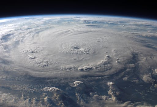
Hurricane Lowell, an exceptionally powerful Category 5 storm, is heading towards Hawaii, bringing significant threats of torrential rain, gale-force winds, and flash flooding. This comes as the Pacific continues to generate numerous tropical cyclones during an El Niño year, highlighting the intense and unpredictable nature of current weather patterns. Forecast to pass just west of Kauai and Niihau, Lowell's rapid intensification and sustained strength are a stark reminder of the escalating challenges posed by extreme weather events. Residents are preparing for potential widespread impacts, making preparedness crucial for the islands.
Hurricane Lowell has been a remarkable and dangerous storm, peaking twice as a Category 5 over Labor Day weekend. After rapidly intensifying from 80 mph to 155 mph in just 24 hours, it became the second Category 5 hurricane in the Eastern Pacific this season and the first to cross into the Central Pacific since Hurricane Walaka in 2018. This intense activity underscores how quickly tropical storms can gather strength in warming oceans, making their impacts more severe and less predictable.
As of Monday morning, Lowell was moving north-northeast, forecast to pass dangerously close to Hawaii's westernmost major islands, Kauai and Niihau. A hurricane warning was in effect for Kauai and Niihau, with a tropical storm watch for Oahu. The storm's path has been influenced by previous cyclones, demonstrating the complex dance of atmospheric systems.
The sprawling eastern side of Lowell is set to unleash torrential rains and gale-force winds across large parts of the main Hawaiian Islands. This poses a serious risk of flash flooding and rapidly rising streams, particularly in flood-prone areas. High surf advisories are also in effect, and while Hawaii's unique topography usually limits storm surge, higher seas coinciding with high tides could still impact lower elevations.
Lowell is predicted to gradually weaken as it encounters stronger wind shear and cooler waters later in the week. However, its current trajectory means it could become the first hurricane on record to pass directly over Niihau. The memory of Hurricane Iniki, which caused billions in damage to Kauai in 1992, serves as a powerful reminder of the potential devastation. Such powerful storms highlight the urgent need for communities to adapt and strengthen defenses against the increasing intensity of climate-driven weather events.
Interestingly, while the Pacific churns with activity, the Atlantic hurricane season remains historically quiet, with development suppressed by strong wind shear and Saharan dust. This contrast illustrates the varied and sometimes paradoxical nature of global weather patterns, yet the overall trend points to a future with more extreme events for vulnerable regions like Hawaii.