Hawaii Faces Major Storm: Its Exact Path Is Still Unfolding

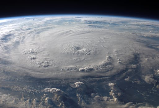
Hawaii is bracing for the potential impacts of Hurricane Lowell, one of three powerful hurricanes currently active in the Pacific – a rare occurrence in over a decade. Lowell, which briefly reached Category 5 strength, is expected to remain a major hurricane as it approaches the islands this weekend. While its exact path is still uncertain, residents can expect significant waves, strong winds, and heavy rainfall. This unusual activity highlights the increased intensity and frequency of such events, signaling a clear call for global warming awareness and climate action.
The Pacific Ocean is currently unusually busy, with three hurricanes churning simultaneously, a sight not seen in 11 years. Among them, Hurricane Lowell is the most concerning for Hawaii. After briefly strengthening to a Category 5 storm, the planet's sixth this year, Lowell is on a path that could bring major impacts to the islands through the weekend. Forecasts suggest Lowell will maintain significant strength, bringing large waves up to 12 feet, wind gusts up to 50 mph, and widespread rainfall between four to eight inches, with isolated areas potentially seeing over ten inches.
While Hawaii’s deep offshore waters generally reduce extreme storm surge, Lowell’s approach coincides with monthly high tides, increasing the risk of higher water levels along the coasts. Historically, Hawaii has faced devastating weather events, from Hurricane Iniki in 1992, which caused billions in damage, to the recent Lahaina firestorm and earlier 2026 Kona low floods, both resulting in widespread destruction and significant loss of life. These events underscore the critical need for robust climate adaptation strategies and global efforts to combat climate change, which fuels more intense and unpredictable weather patterns.
Meanwhile, Hurricane Marie in the eastern Pacific is also creating dangerous swells for Mexico and California, with unusual early-September rain possible for Southern California, increasing flash flood risks in certain areas like slot canyons. On the other side of the globe, the Atlantic has remained remarkably quiet, setting a historical record for the latest first hurricane of the season. This stark contrast in storm activity across different oceans is a clear signal of the powerful, globe-spanning effects of the current fast-intensifying El Niño, demonstrating how changing climate conditions can redistribute and amplify extreme weather events worldwide.