Historic Dolphin: What This Cat 5 Typhoon Reveals Now

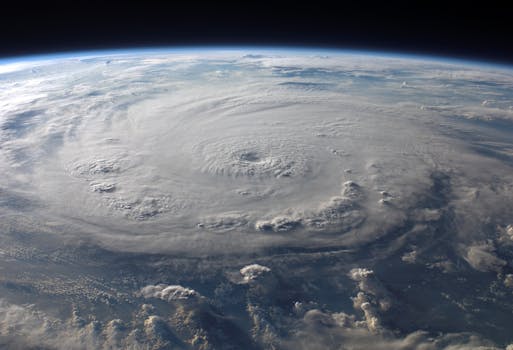
Super Typhoon Dolphin has just become the fifth Category 5 tropical cyclone of 2026, marking a historic and alarming trend. This powerful storm rapidly intensified over exceptionally warm ocean waters, a factor increasingly linked to climate change. Dolphin's strength and its unusual formation location near the International Date Line are also consistent with a strong El Niño event, which supercharges Pacific cyclone seasons. As our planet continues to warm, such intense and destructive storms are becoming more frequent, urging a global focus on environmental action and sustainable solutions. This event serves as another stark reminder of the urgent need to address global warming.
Super Typhoon Dolphin recently surged to Category 5 strength, becoming the strongest typhoon ever recorded so close to the International Date Line. This rapid intensification, happening in less than 36 hours, was fueled by unusually warm ocean waters, reaching temperatures between 84°F and 86°F (29°C to 30°C), combined with low wind shear. While Dolphin currently poses no immediate land threat, its sheer power and unusual path make it a storm to watch closely as it may eventually impact the sparsely populated Ogasawara Islands, then move near the Nansei Islands (Ryukyu Islands) before heading towards the East China Sea, as predicted by models like the Google DeepMind model.
Dolphin is the fifth Category 5 storm globally this year alone. It follows others like Hurricane Genevieve, which reached Cat 5 off the coast of Mexico, and Super Typhoons Horacio, Sinlaku, and Bavi. Super Typhoon Sinlaku made landfall over the U.S. Northern Mariana Islands, causing an estimated $1.5 billion in damage and 17 fatalities. Super Typhoon Bavi also devastated Rota Island in the U.S. Northern Mariana Islands and caused 23 deaths in the Philippines. This intense cyclone activity is closely tied to a strong El Niño event, which typically creates conditions for more powerful and longer-lasting typhoons in the Pacific by shifting their formation areas eastward over warmer waters.
The increasing frequency and intensity of these super-strong storms is a worrying sign of our changing climate. Data shows a statistically significant rise in Category 5 storms globally since accurate satellite data became available in 1982. Scientists anticipate that global warming will continue to increase the proportion of tropical cyclones reaching these most destructive categories. This trend underscores the urgent need for global environmental action, demonstrating how our warming world directly contributes to more extreme weather events and the devastating impacts they bring. Protecting our planet through sustainable choices and reducing emissions is critical to lessening the future's storm intensity.